Date: 14 March 2015Equipment: DS Rev 3 (aka Dogeship-3)
Launch: Greensboro, NC
Landing: Warrenton, NC
Time of Flight: 89 Minutes
Distance Travelled: 91 miles
Burst Altitude: TBD (~61,000 ft)
Date: 14 March 2015Equipment: DS Rev 3 (aka Dogeship-3)
Launch: Greensboro, NC
Landing: Warrenton, NC
Time of Flight: 89 Minutes
Distance Travelled: 91 miles
Burst Altitude: TBD (~61,000 ft)
After our first successful balloon launch with EFT-2 (still to be recovered), plans for EFT-3 were immediately underway with great enthusiasm and vigor. The biggest planned improvement (aside from launching in a warmer location) to the hardware arsenal for EFT-3 would aim to prevent the payload from getting stuck in the tree, by means of a “cut-down” circuit.
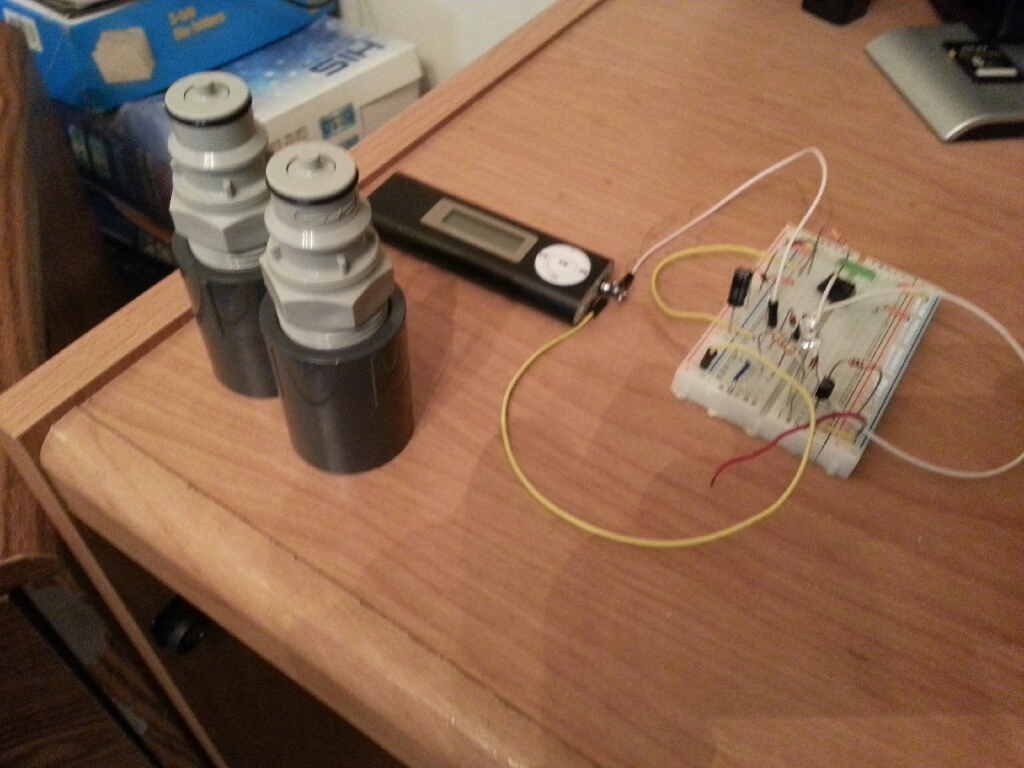
The thought of the cut-down circuit would be to attach the payload to the parachute via a single string, and activate a mechanism which would sever that attachment and allow the payload to fall from the tree while the parachute remains suspended in any branches. The original concept would use the phone as the activation mechanism. By playing an audio signal (none other than the Star Spangled Banner for us) from the phone, it would trigger a signal in a circuit and trigger a relay to dump current from a small battery through a piece of Nichrome wire. The hot Nichrome wire would melt the attachment to the parachute, and voila! The payload would fall from the tree. Unfortunately, the cut-down circuit was abandoned last-minute due to insufficient time for prototyping and getting the circuit ready. However, there are plans to use the cut-down circuit as a means for delaying the deployment of the parachute on descent in the future to further reduce mission distance.
In addition to the cut-down prototype, we were ready to try for a higher altitude in order to capture more spectacular pictures. The Kaymont 600 balloon has a published burst altitude of 75,000-90,000 feet. The plan was to fill it with an entire 125 cu ft. tank again, which is an overfill condition and would result in a pre-mature burst altitude somewhere below the published burst altitude, but would allow us a shorter driving distance for recovery.
The last major detail was planning the location. Priority 1: it should be warmer than the first two launches. Priority 2: again, let's do a warm launch! The team decided to take a flight to Durham, NC to visit a family member currently attending Duke University there and launch in North Carolina (warm!).
Pre-Flight
The launch date was selected for the March 13 weekend and plane tickets were booked. A Test Readiness Review (TRR) meeting was held again 1 week prior to ensure that nothing was overlooked and that the pre-flights were completed and go/no-go launch criteria established.

Mission Objectives
Primary Objectives (Mission Critical):
- Verify Telemetry (TM) system utility, including collection of lost frames
- Verify Payload Cutdown System
- Verify validity and assumptions of flight simulation using TM and Flight Data Recorder (FDR) data
- Finalize TRR, Preflight, and Launch Procedures
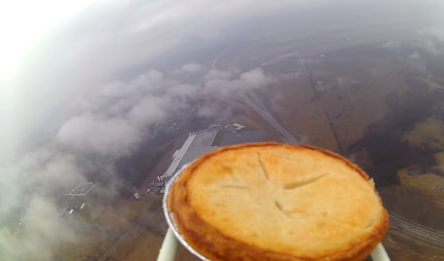
- Optional Objective: Record photos during ascent and descent
EFT-2 Flight Hardware
The hardware configuration for EFT-3 was exactly the same as with EFT-2, with the exception of using a smaller parachute for a faster descent, and a Kaymont 600 balloon instead of a 350 for additional altitude before burst. The cell phone was a different model, but served an identical purpose by running the latest TM software for EFT-3.
Risks
In addition to much more rigorous flight planning, the highest risks for EFT-2 were determined as outlined in the chart below. The cut-down device had been originally planned to retire the "tree landing" risk, but had to be abandoned last minute due to lack of testing.
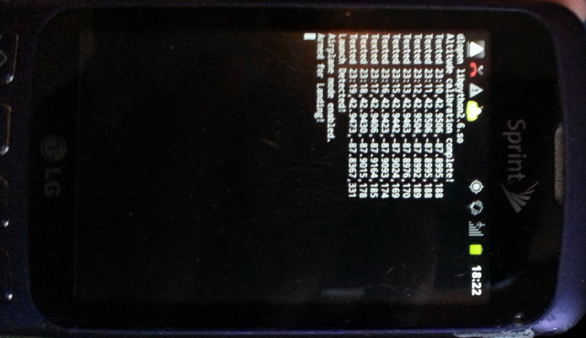
Telemetry
The Telemetry (TM) software was updated for EFT-3 to allow for a few improvements and to test some theories for future flights.
Mainly, the TM software was updated to be able to receive commands once back on the ground, to allow for changes in the message length, the frequency of which messages are sent, and a few other parameters. The software also accepts the “sever” command for the cut-down mechanism, which may prove to have use in future flights as a cut-down or parachute delay mechanism.
Launch Day
| Parameter |
Imperial |
S.I. |
| Final Payload Weight |
1.8 lbs. |
0.8 kg |
| Measured Nozzle Lift |
6.2 lbs. |
2.8 kg |
| Free lift (Nozzle lift – payload weight) |
4.5 lbs. |
2.0 kg |
| Estimated Burst Altitude |
79,000 ft. |
24,000 m |
Launch Log:
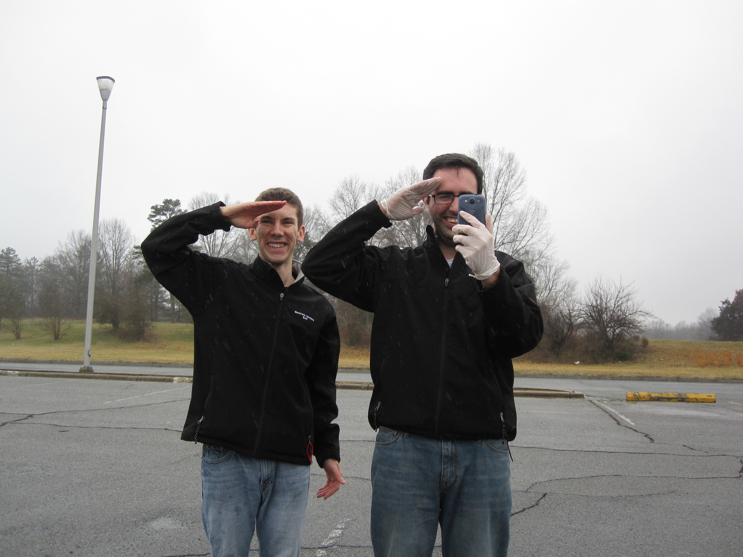
0 minutes – with a small speech and the dual-salute, EFT-3 is sent off. She disappears into light mist falling from the thick clouds. We flew down to NC for this; we weren't about to scrap our launch just because of a little rain!
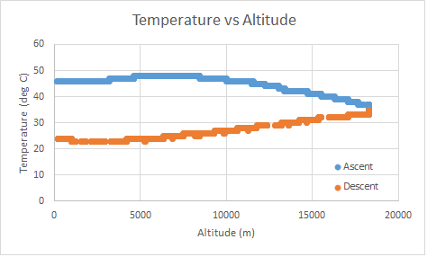
1 minutes – Communications have already ceased. Although not unexpected this flight, we had hoped to maintain communications a little longer before losing contact. A plot of temp vs. time shows that the temperature is much more reasonable with 2 hand-warmers. And now we wait.
 75 minutes – modeled landing time. Still no messages have been received.
90 minutes – CONTACT. EFT-3 is on the ground in the middle of no-where. She appears to be right on the fringe of what appears to be a grove where very tall trees meet some very short bushes. We route towards the landing zone and wishfully hope that it is in the small bushes…
100 minutes – our team parks at a Methodist Church just outside the tree farm. After 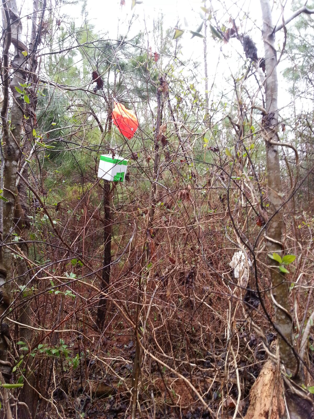 reading the posted signs that just forbid firearms and hunting on the land without a permit, we proceed to walk the mile or so towards EFT-3. SMS messages are still coming in loud and clear.
As we proceed along the banks of a small stream, we near the location where the EFT-3 TM beacon has been emitting from. Tall trees on our right, but small trees to our left….still praying that EFT-3 landed a little to the left.
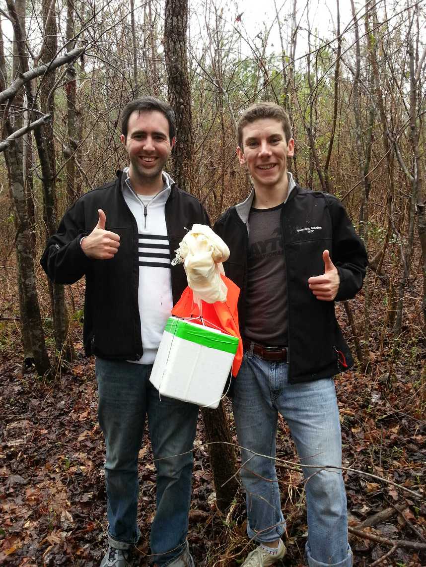
120 minutes – we see her, and she’s on the ground! After de-tangling the lines from thorn bushes, we start the trek back out.
Conclusions:
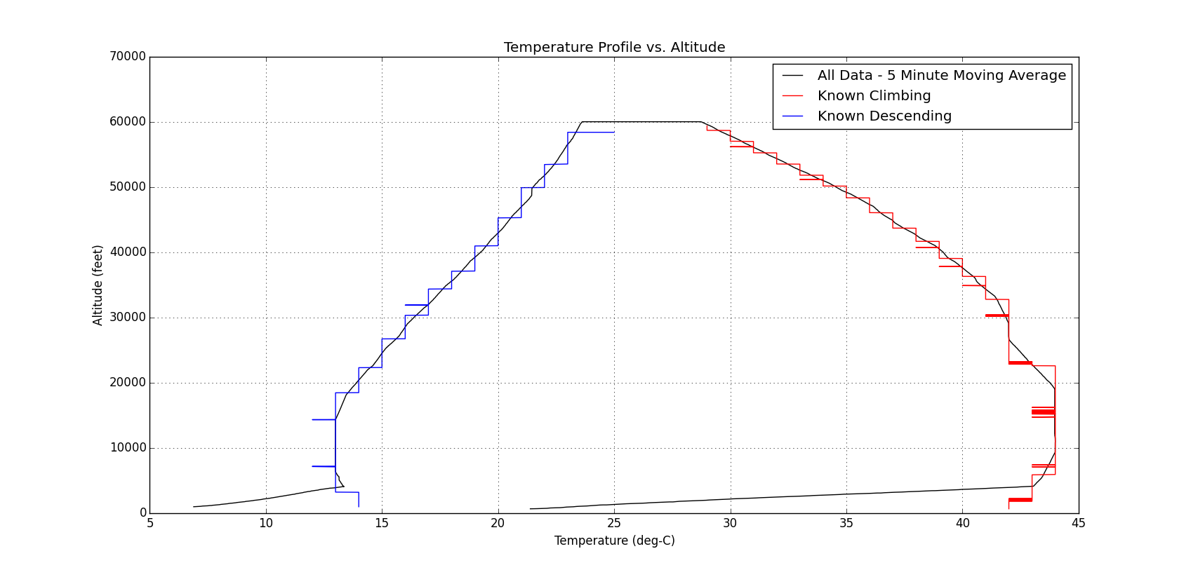
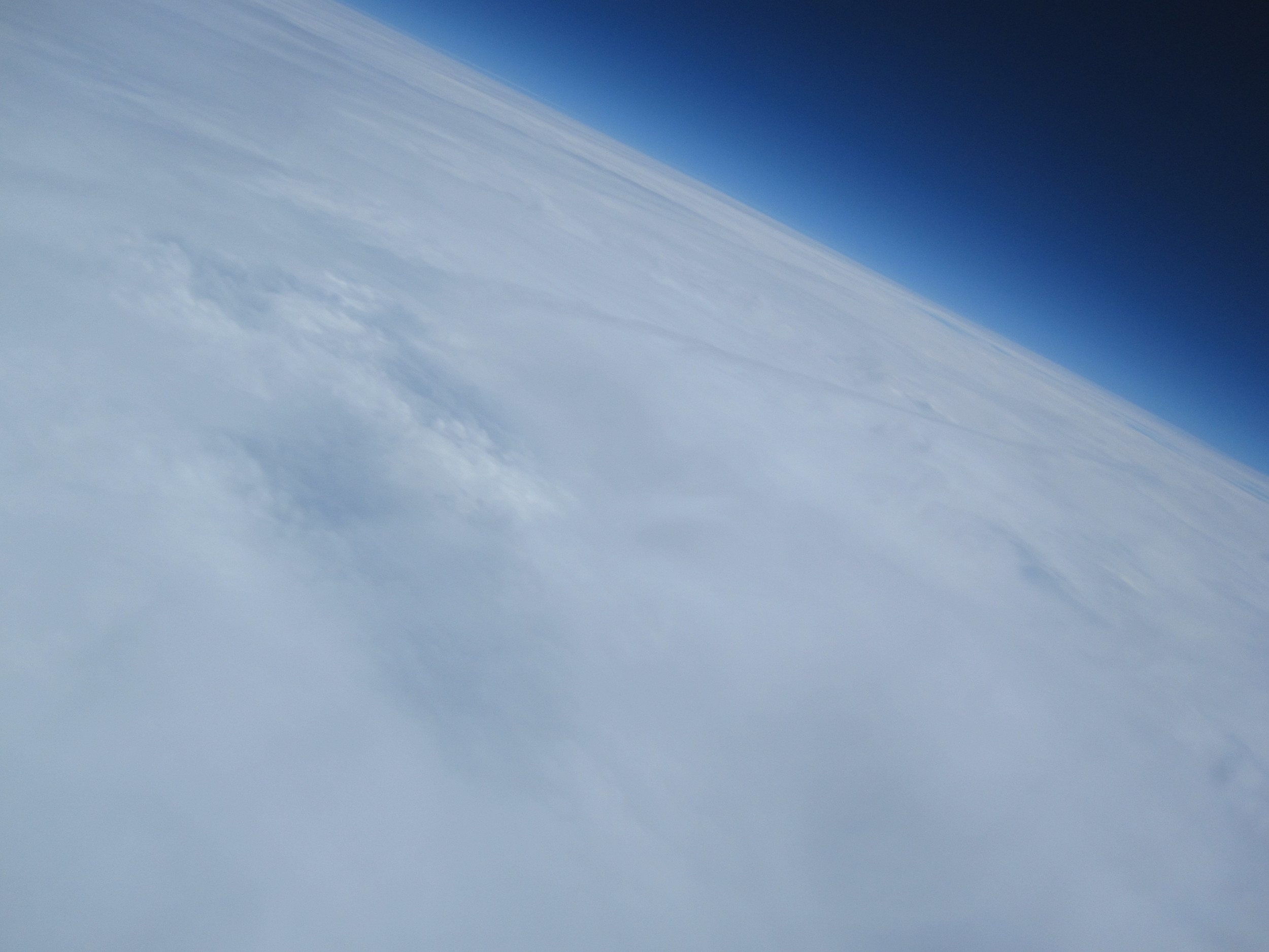
EFT-3 marks the first successful recovery of a launch, including access to both the FDR data and camera pictures. Although it appears that the balloon may have burst earlier than anticipated (even for the overfill condition), the descent ended up going much longer than expected, so we lucked out in not having it go as high as it could have.

The pictures up at the high altitudes indicated that the payload was experiencing severe sway, potentially flipping end over end at times. It is also worth noting that  the balloon to parachute attachment line had wound itself around the parachute
suspension lines about half way up, which
effectively reduces the line length and hence reduces the drag coefficient of the parachute. For future launches, a longer balloon to parachute attachment line should help increase stability, and hence make it more stable on ascent. Furthermore, a parachute deployment mechanism (potentially utilizing the cut-down device hardware) that waits until a prescribed altitude before deploying the parachute would decrease the changes of any lines tangling and reduces the distance and time that would be required for recovery.
the balloon to parachute attachment line had wound itself around the parachute
suspension lines about half way up, which
effectively reduces the line length and hence reduces the drag coefficient of the parachute. For future launches, a longer balloon to parachute attachment line should help increase stability, and hence make it more stable on ascent. Furthermore, a parachute deployment mechanism (potentially utilizing the cut-down device hardware) that waits until a prescribed altitude before deploying the parachute would decrease the changes of any lines tangling and reduces the distance and time that would be required for recovery.
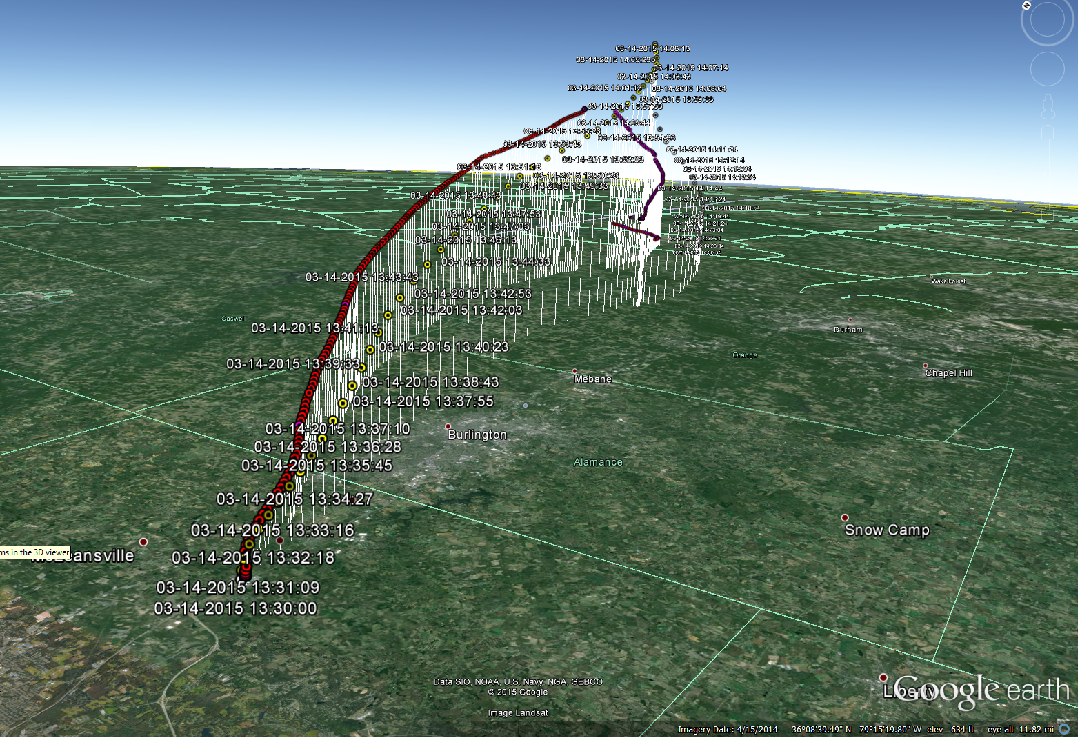
Comparison of the actual GPS (red) with pre-flight predictions (yellow) show good correlation with winds, taking into account earlier than expected burst of actual system.
For those interested, the plot of temperature vs. altitude shows that our hand-warmers and cooler insulation design maintained the cell phone temperature within a desirable range for the duration of the flight.