 Telemetry is the remote measurement of data and the automated communication of that data to monitoring devices. If you are looking to get your amazing near-space pictures back after your flight, ensuring that you have a solid Telemetry System on board for successful recovery is a crucial part of any launch.
Range Telemetry System Options
Telemetry is the remote measurement of data and the automated communication of that data to monitoring devices. If you are looking to get your amazing near-space pictures back after your flight, ensuring that you have a solid Telemetry System on board for successful recovery is a crucial part of any launch.
Range Telemetry System Options
One of the earliest and most critical studies conducted was on our spacecraft recovery methods. The spacecraft itself, while low cost, contains important photos and data on board -the desire is to maximize the probability of recovery. A study was conducted to determine the feasible systems for tracking the balloon during the ascent and descent phases. It was determined that there were three options for tracking – an RF radio link, a cellular phone, and an Iridium (or other constellation) satellite text messaging system.
RF Radio Link
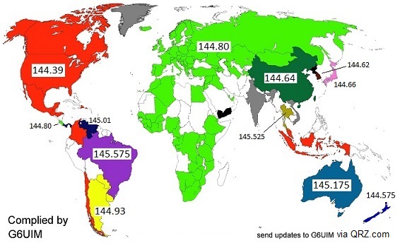
A network of HAM radio operators exists throughout the world that has radios tuned to listen at specific frequencies, listed in the chart below. This group of operators makes up the Automatic Packet Reporting System (APRS) network, and can receive digital communication with the in-flight balloon. The balloon transmits the GPS coordinates and other information using a radio transmitter while in-flight. The success of this type of tracking system depends on the balloon being within the line of sight of one or more ground towers throughout the flight. The accuracy of this system would be good at high altitudes, but the quality of the data track will diminish as the balloon launches and descends near to the ground due to sparse receiver stations.
One key caveat with this system is that the APRS transmitter needs to be combined with a microcontroller and an external GPS to provide updates.
Cellular Phone
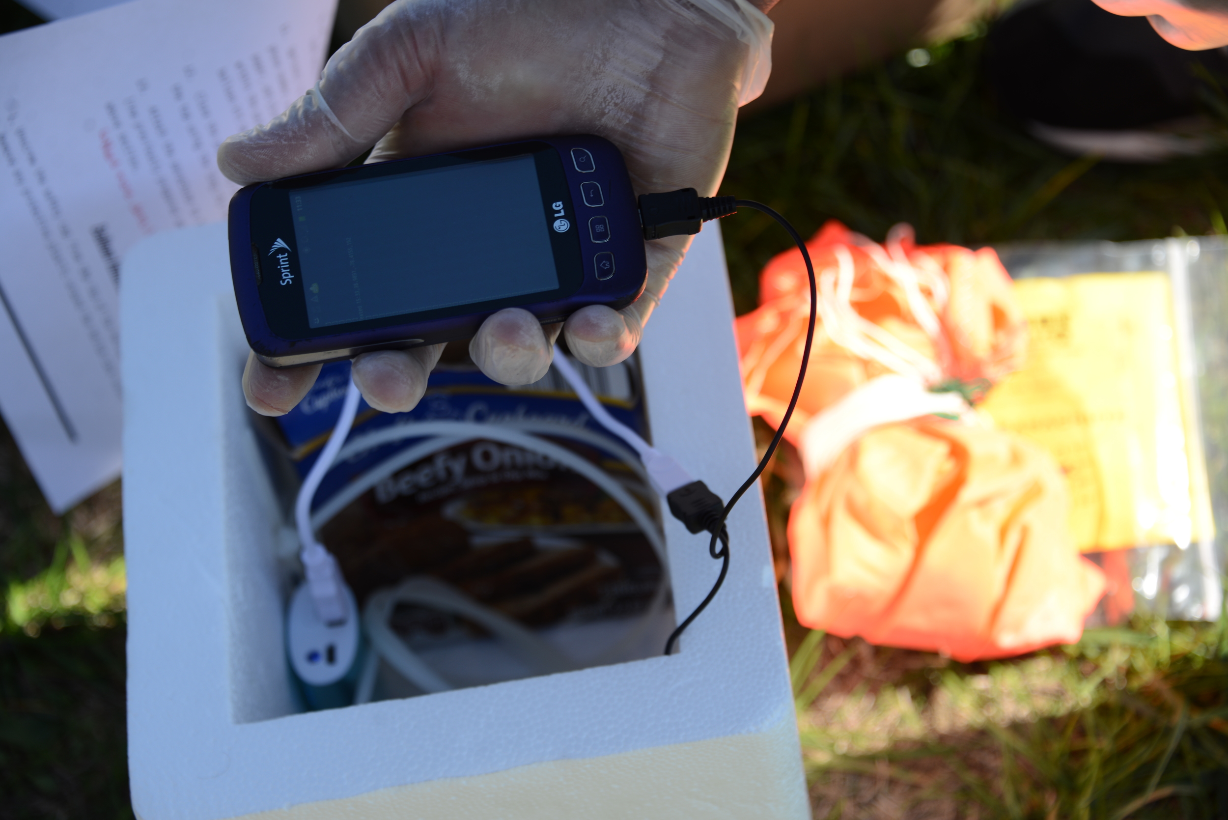
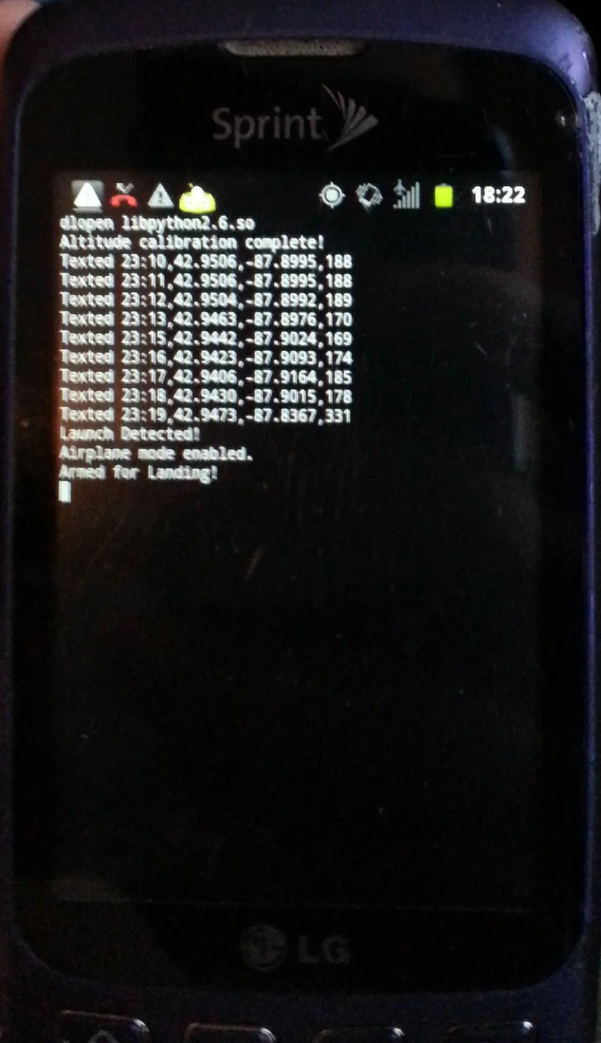
 A cellular phone was investigated for use as a tracking and telemetry system. The concept of operations of this system would be to program the cell phone to record its current GPS position and relay this information to a ground station using either a text message or a data connection. This system is low cost and high accuracy, but suffers a few drawbacks. FCC Regulation 22.925 prohibits the use of cell phones for in-flight tracking, as it states that cell phones "aboard airplanes, balloons or any other type of aircraft must not be operated while such aircraft are airborne (not touching the ground)". Although enabling Airplane mode while in-flight allows compliance with the FCC regulation, this prevents any in-flight updates other than those while on the ground.
Additionally, the GPS receiver in most cell phones is a commercial grade receiver and will only provide a GPS lock at altitudes below 60,000 feet. Finally, there is also the risk that the balloon will descend into an area with minimal cell service, severely limiting the ability to recover the vehicle.
Iridium Satellite Communications
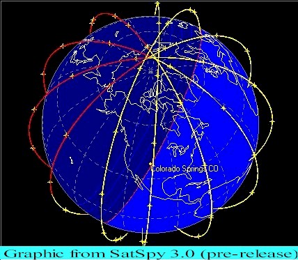 Recently a number of companies have begun offering text message service using the Iridium satellite constellation using low power, low weight devices. These text messages come pre-encoded with the GPS position of the device at the time of message transmission. This system could be used to provide consistent and reliable messaging from the vehicle to ground stations. This system also provides a means of two-way communications from the ground up to the vehicle for command and control. The primary drawback of this system is cost – the devices can cost anywhere from $150 and up, with a $500 price point for two-way capable devices. Additionally, they all require a connection plan with some requiring an annual commitment. The device also has a commercial grade GPS receiver, meaning that as with the cell phone the GPS position reporting will cease to function above 60,000 feet.
Which Telemetry System is Right for Me?
To answer the question of which telemetry system is right for your weather balloon project, you must trade off the various options.
Do you have a large budget and want the most reliable, off-the-shelf solution? It sounds like a Satellite Constellation, such as the GPS SPOT Tracker, may be right for you.
Are you a hardcore do-it-yourselfer, looking to invest some time into building your own tracker and not afraid of getting your HAM radio license? APRS tracking may be the path for you. APRS trackers are also available for sale, but we have found that they are typically even more expensive than the SPOT trackers.
The Cell phone was our Telemetry system of choice on our first four launches, due to it's low cost, extremely easy access to a multitude of integrated sensors through a Python program, and flexibility for programming options and future potential of controlling other system features (see the cut-down mechanism that we prototyped before EFT-3). Our primary goal is to drive the cost and complexity of this hobby down so that more people can participate. We also wanted to ensure that, for our research flights, we were OK with losing the entire cost of the payload in case we did not get it back! In addition to tracking, our software also runs an in-flight data recorder to record all of the sensors, GPS position, temperature, etc during flight for making charts back on the ground after the flight.
Whatever your decision, one thing is for sure: there are many ways of tracking your weather balloon, and they are constantly changing and evolving!