Date: 11 October 2015 Equipment: DS Rev 4
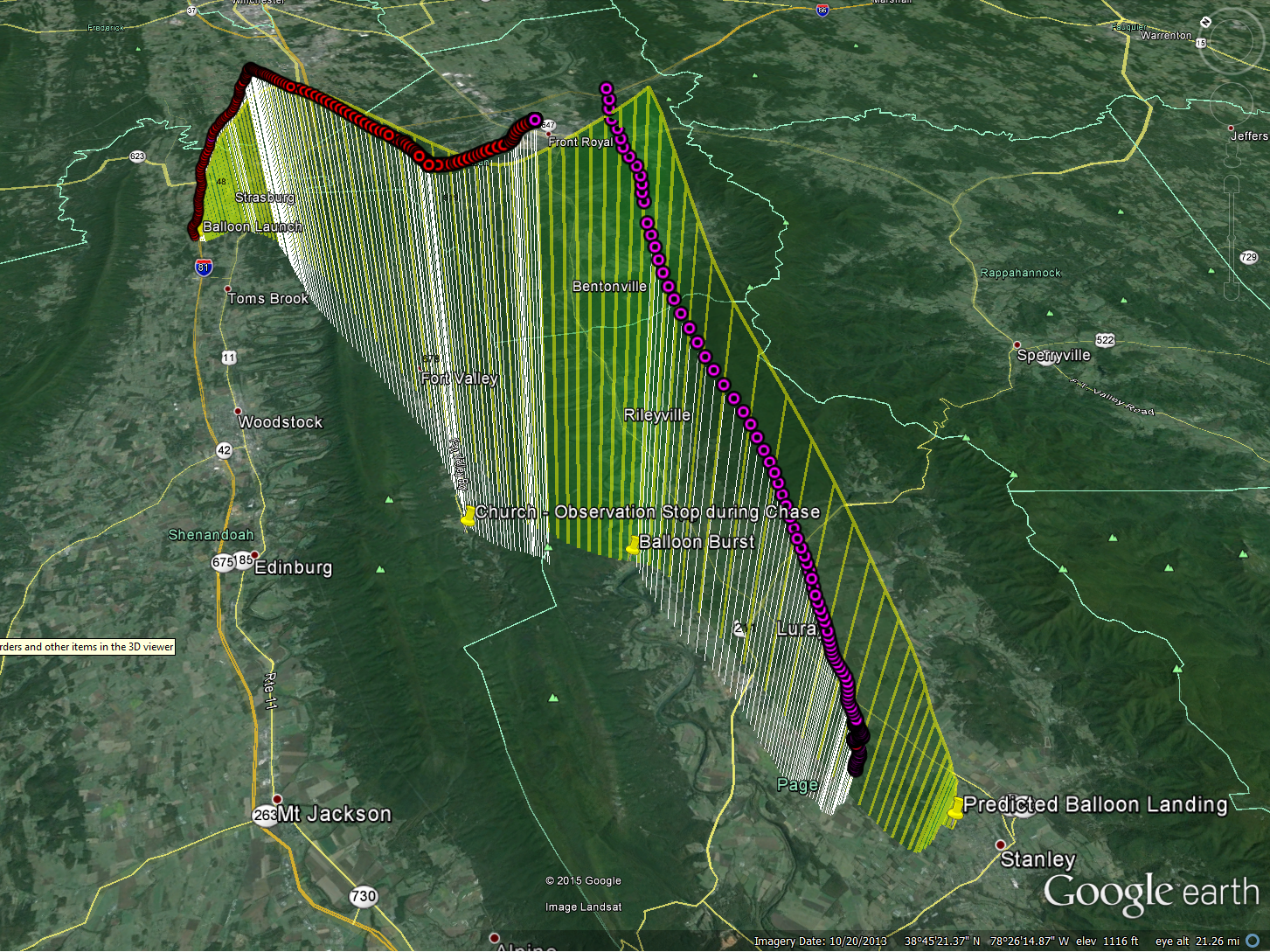
Launch: Fishers Hill, VA
Landing: Luray, VA
Time of Flight: 93 minutes
Distance Travelled: 26 miles
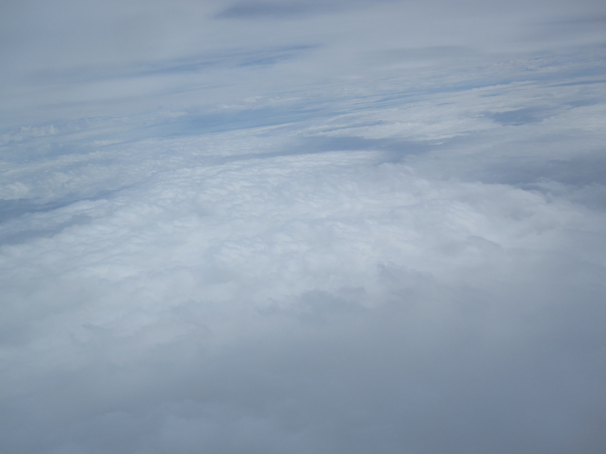
Burst Altitude: (~65,000 ft)
Equipment: DS Rev 4
Launch: Fishers Hill, VA
Landing: Luray, VA
Time of Flight: 93 minutes
Distance Travelled: 26 miles
Burst Altitude: (~65,000 ft)
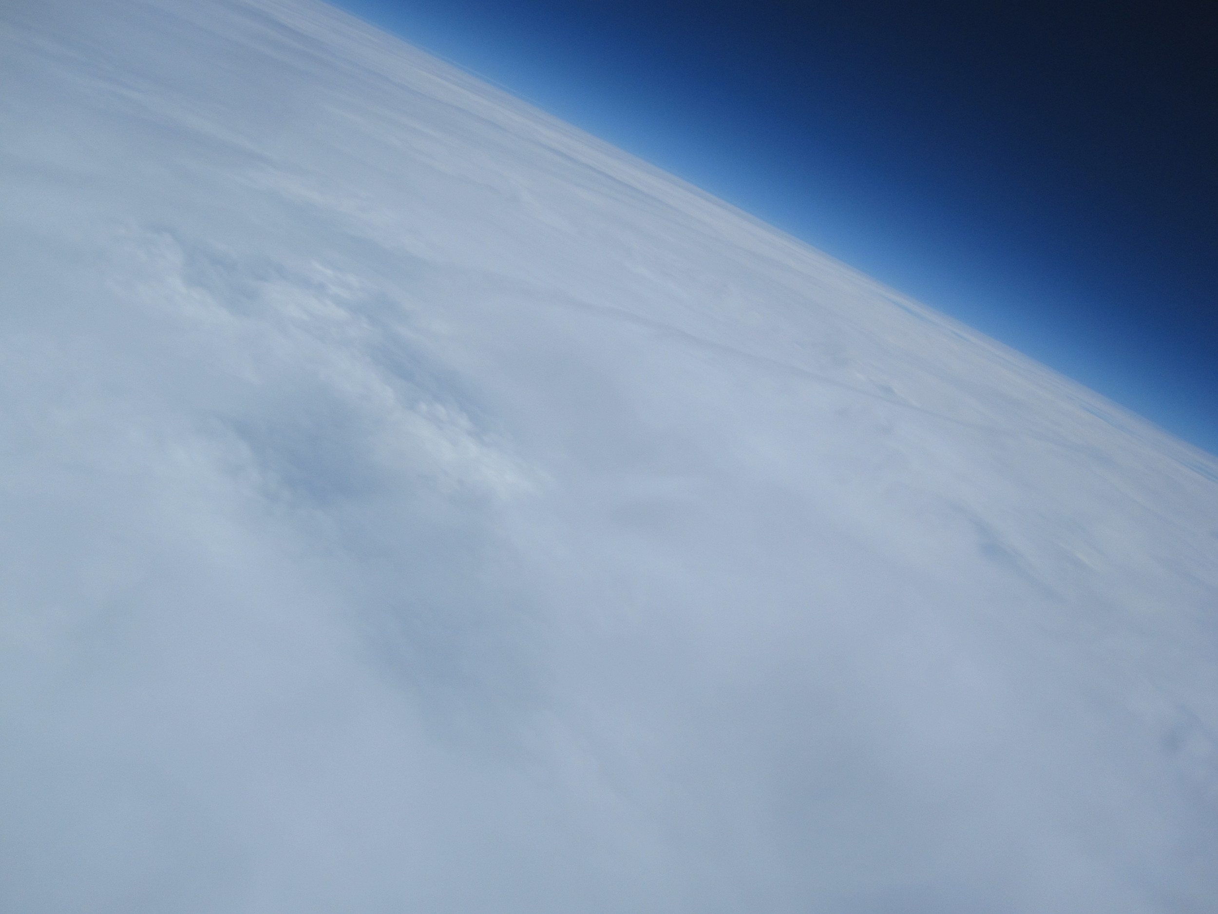
After the successful launch and recovery of our EFT-3 HAB, we were incredibly eager to put another Dogeship-class weather balloon back into the skies and capture some more stunning photos (and hopefully video) of the Earth. There is something truly awe-inspiring about sending a spacecraft high enough that only a tiny fraction of a percent of ALL of humanity that has ever existed has been able to accomplish a similar feat. We live in a wonderful time of endless technological possibilities and knowledge sharing that makes all of this possible.
One of our goals from the start has been to make this invigorating experience of capturing near-space photos of Earth’s curvature more accessible to those that may not think that it would be even possible: photographers, younger students, and those that have knowledge of perhaps some sub-system of the weather balloon craft but don’t have the skills or confidence that they would be able to pull off all the components that go into a HAB launch.

Enter: EFT-4. Because of all the lessons that we learned throughout the first three launches, we have been assembling a step-by-step user guide that will walk through each of the critical aspects of a HAB Near-Space Weather Balloon launch, and hopefully lead to successful photos and recovery. EFT-4 was our first time letting two complete strangers that have never launched a weather balloon before to try out our user guide, our inflation system, and essentially launch a balloon with minimal guidance from us.

We hope to share our knowledge and help anyone launch a weather balloon, and this user guide is now available for FREE download after signing up for our mailing list here.
Pre-Flight
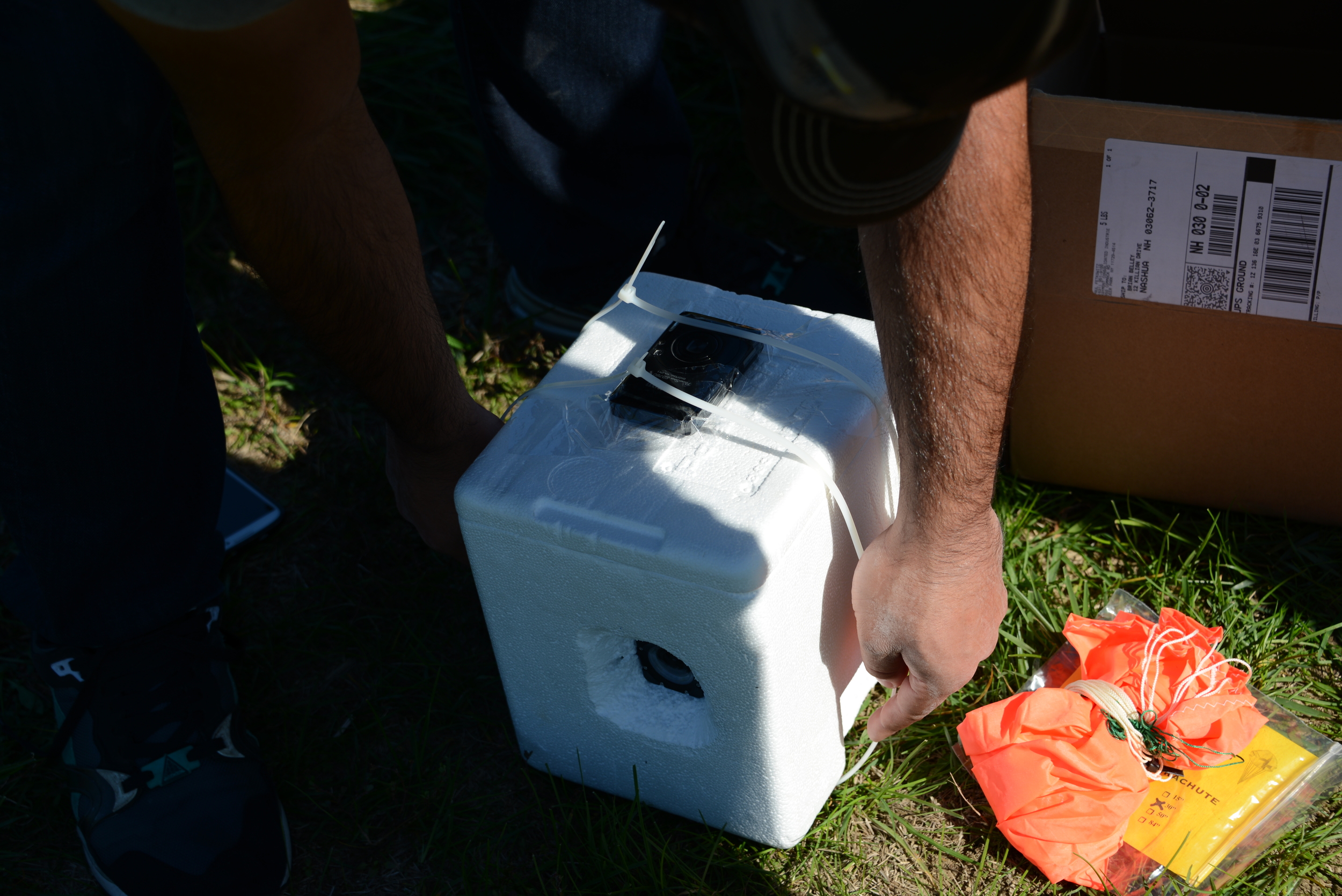
As mentioned in the previous brief overview post of EFT-4, the plan was to flight-test our planned configuration that we had written the user guide around. The only additional component that we included on this flight for data-gathering purposes was our trusty Canon SD 780IS running the CHDK (Canon Hack Development Kit) software to take video on ascent while looking straight up at the balloon.
The details of the flight configuration for predictions of EFT-4 were:
 Payload Weight = 1.79lbs
Nozzle Lift = 6.00 lbs (see an explanation of Nozzle Lift here)
Parachute = 30”
Cameras: 1 RioRand RS4000 (1080p video), 1 Canon SD780IS (720p video)
Parachute to Balloon Length = 60” (one string)
Parachute to Payload Attach = 40’ (one 40lb test string, attached to payload through two zipties)
Payload Weight = 1.79lbs
Nozzle Lift = 6.00 lbs (see an explanation of Nozzle Lift here)
Parachute = 30”
Cameras: 1 RioRand RS4000 (1080p video), 1 Canon SD780IS (720p video)
Parachute to Balloon Length = 60” (one string)
Parachute to Payload Attach = 40’ (one 40lb test string, attached to payload through two zipties)
Interestingly enough, the predicted winds on the launch date and time in the Shenandoah valley were southerly, and only expected to carry the balloon roughly 20-30 miles. If we planned it right, we may be able to catch a glimpse of our EFT-4 HAB on descent!
Launch Day
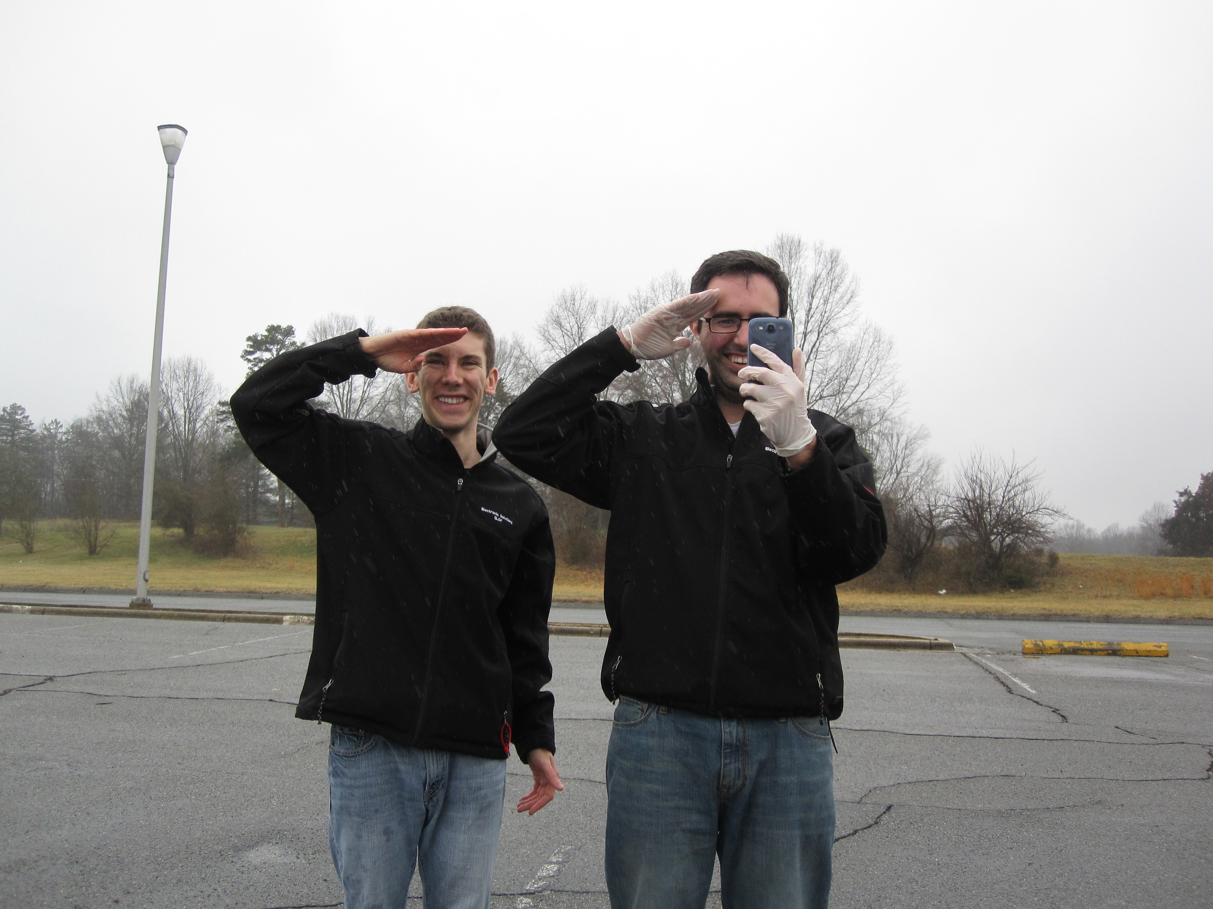
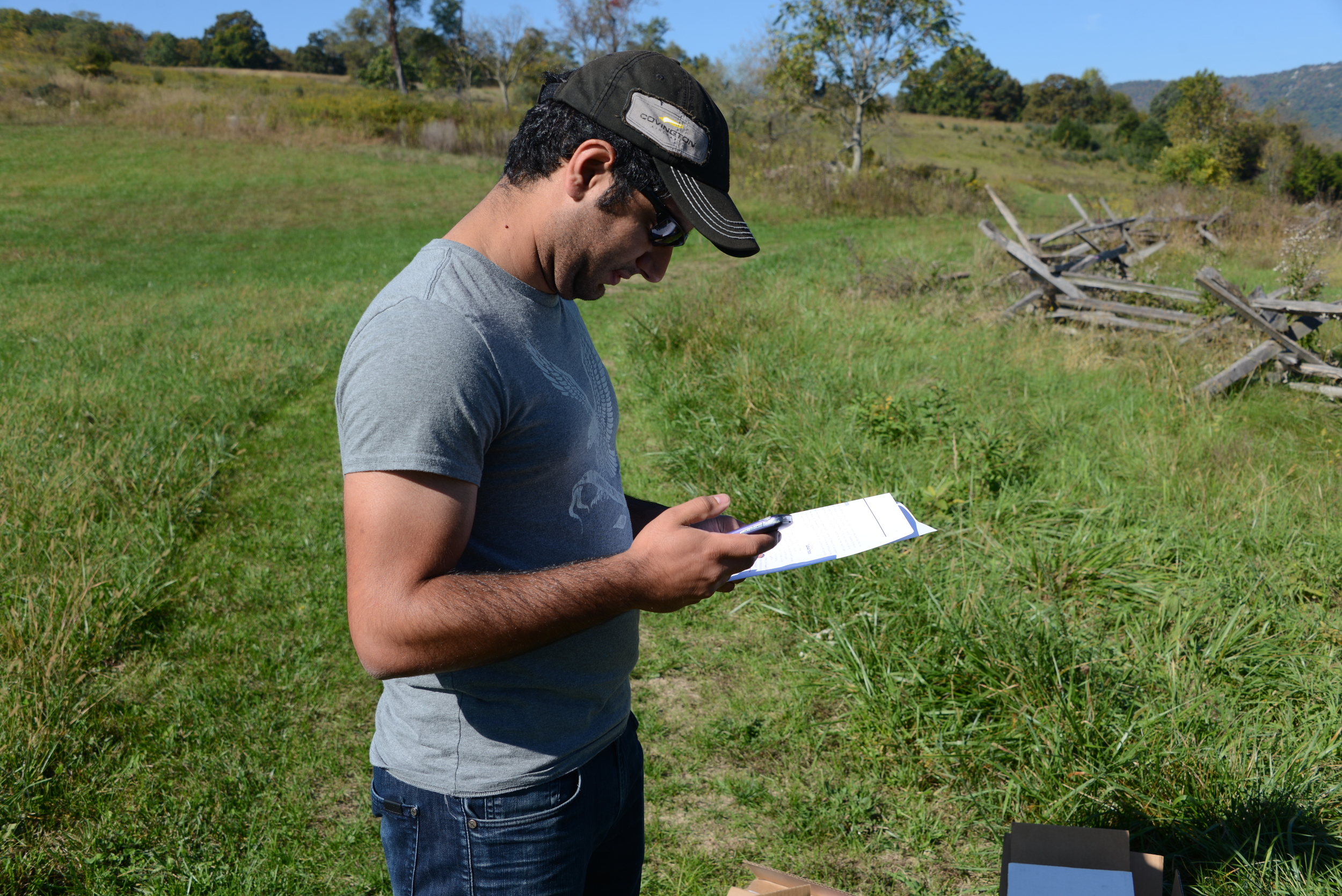 Our guinea pig for the day was Shahin. Although Shahin has an Aerospace background, the entire process of launching a weather balloon was entirely foreign to him. After running our last-minute pre-flight checks and selecting what seemed to be an appropriate launch site (an old Civil War Battlefield), we set out for our destination and prepared to launch.
 Although some questions arose during the process, which was our main intent of having someone unfamiliar run through the steps for launching the HAB, overall the pre-flight preparations ran smoothly. Another friend that had not taken part in a balloon launch before, Billy, had graciously offered to be the paparazzi for the day and captured photos during the entire process.

With the payload prepped, balloon inflated, and all pre-flight checks indicating a GO, Shahin gave the customary launch speech, and away EFT-4 went!
Launch Log
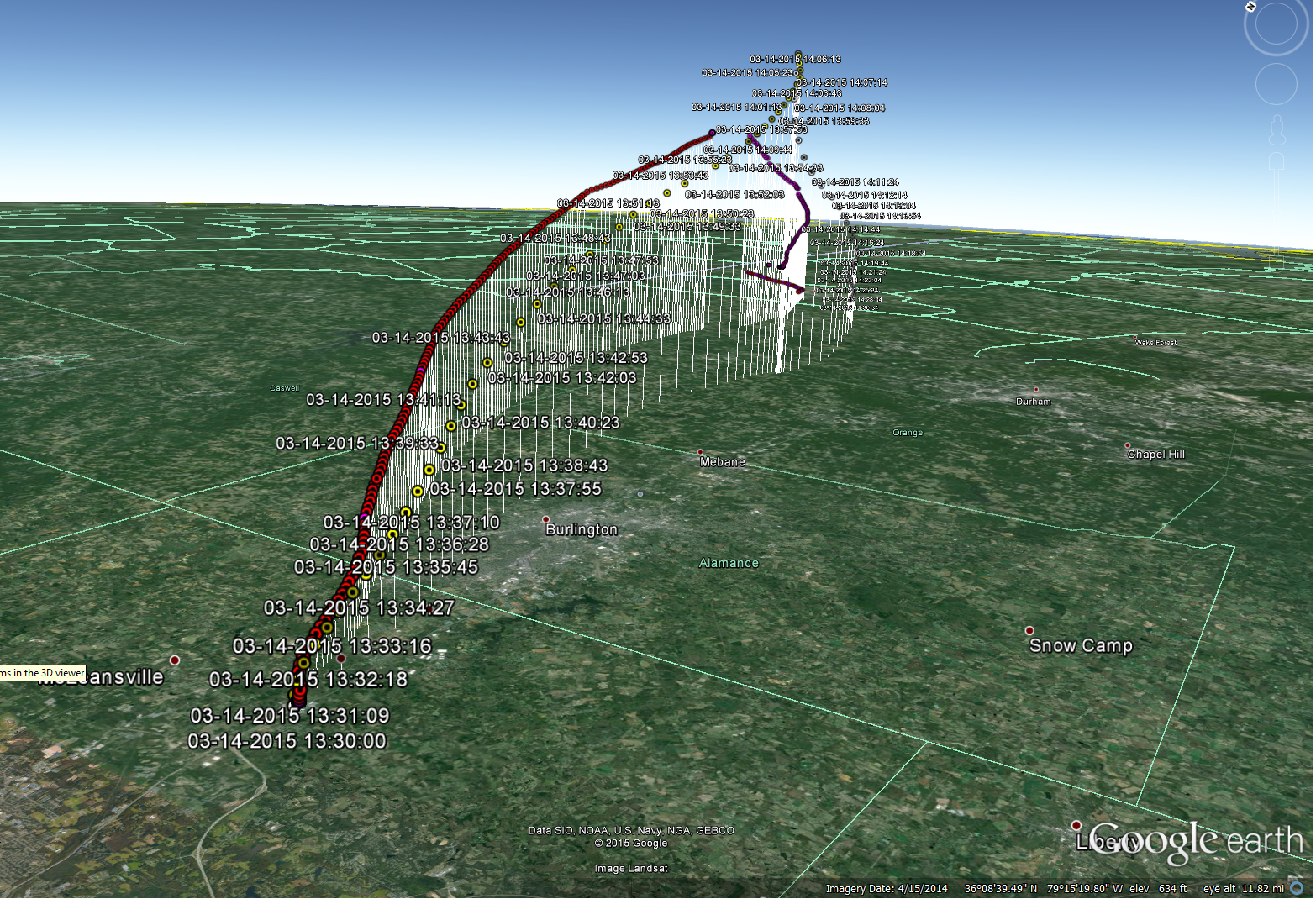
Time of Launch: 12:26PM EST
Launch Coordinates: 38.9896069,-78.4169555 (601 Battlefield Rd, Fishers Hill, VA 22645)
Time of Recovery (in-hand): ~2:30PM EST
Landing Coordinates:38.6178,-78.5064 (3348 Mill Creek Rd Luray, VA 22835)
0 minutes: Godspeed, Dogeship-4!
https://www.youtube.com/watch?v=qWjSFiQWrAo
2 minutes: Initial SMS messages indicate a nominal ascent rate, in lines with our pre-flight predictions. SMS messages cease (as programmed) once the launch-detect algorithm detects the launch and puts the phone into Airplane mode. We’ll see you on the other side, Dogeship.
5 minutes: Although we’re not receiving communications because of the phone being in Airplane mode, we can still see her! Looking out the moonroof, she is climbing strong (and also rotating pretty violently….).
10 minutes: Based on initial climb and pre-flight predictions, we anticipate possibly being able to drive underneath the point of burst. Although we don’t expect to see her, we figure we will drive to that point along the Shenandoah valley ridge and give it our best shot. Meanwhile, up at 13,000 ft. altitude...
https://www.youtube.com/watch?v=0srqlL6Zt14
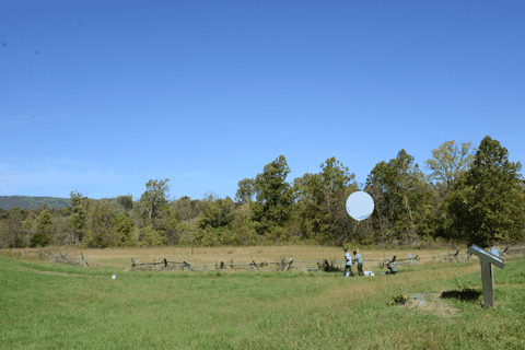
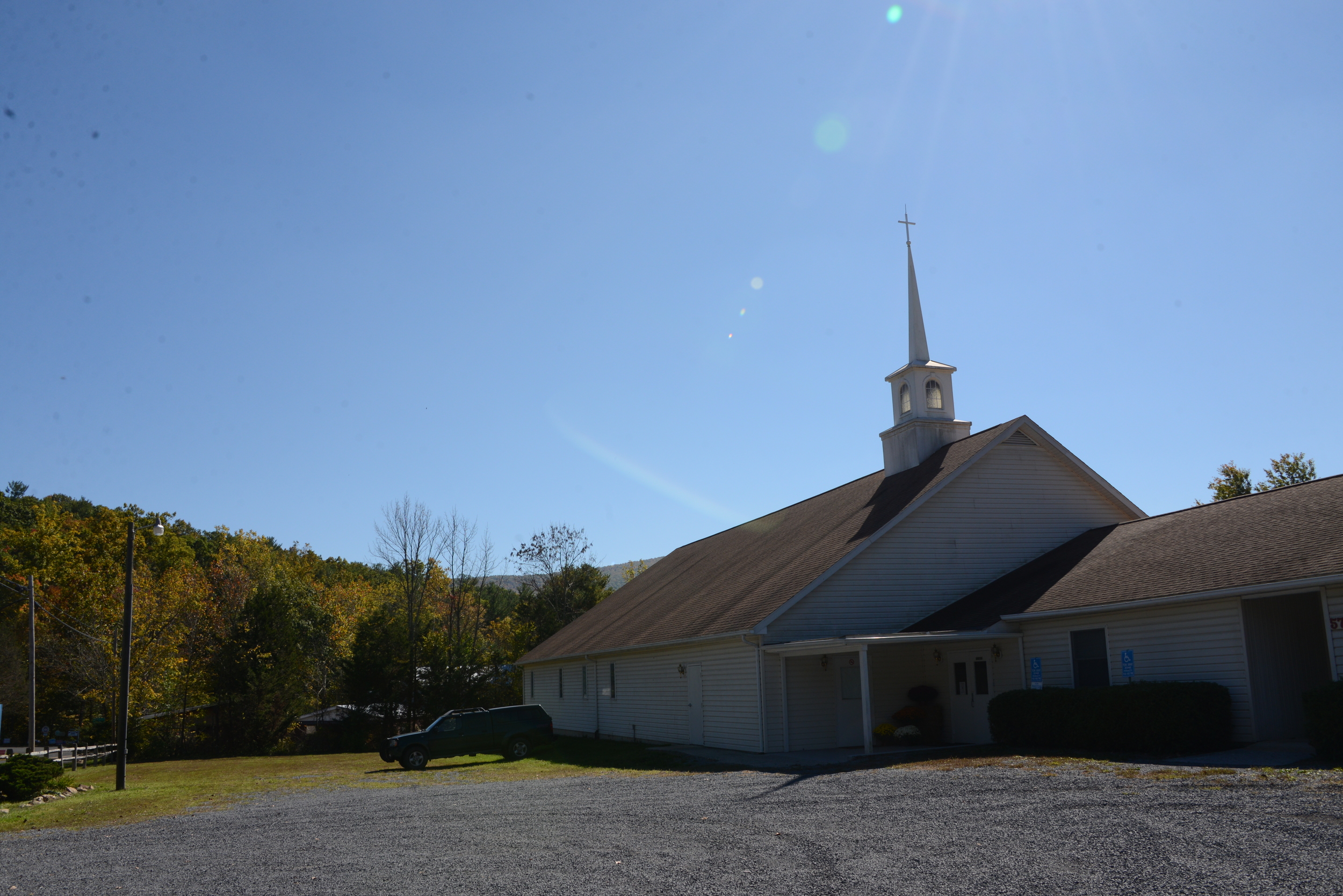 25 minutes: We arrive at the intersection underneath the expected point of burst, and pull over in a Church parking lot. Again, not expecting to see anything (but still desperately hoping so), we hang out here for roughly 10 minutes. Updated in-flight predictions show that she may actually be going a little more north (towards the left of the Church in the picture), and unfortunately not traveling as far as we originally predicted. We decide to drive slightly north to see if we can scope out the area.
It's around this point in time when both the Riorand Camera and the Canon camera videos stopped. The Riorand froze most likely due to overheating (still powered up upon recovery), while the Canon camera likely froze due to the cold. Here is the entire ~24 minutes of flight looking up from the payload at the balloon. It's a violent flight, so hang on!
https://www.youtube.com/watch?v=17Zqec1P-_g
40 minutes: Landing zone assessment: not optimal at all. Trees everywhere! And worst of all, absolutely no cell phone service. If the updated pre-flight predictions are correct and she ends up landing short along the ridge, it is starting to appear that our chances of recovery (and of even hearing back) are pretty slim.
50 minutes: Because we have no cell service, we decide to drive to the top of the ridge. What a view! The beautiful fall foliage overlooking the valley almost makes us forget about how grim our prospects are starting to look for a successful Dogeship-4 recovery (almost).
60 minutes: With a few bars of service on the top of the ridge, we still haven’t heard anything from our Dogeship. Expecting to have heard back for nearly 10 minutes but not receiving a single text and fearing the worst, we decide to take a hike up the trail on the ridge.

80 minutes: Long past when we expected to receive an SMS and hanging on to what little thread of hope remained for a recovery, we finally get a GPS coordinate message! She just cleared the landing altitude detection threshold...she’ll be on the ground in only a few minutes, and is only a 20 minute drive from us (within 2 miles of where we originally anticipated the landing). Quickly abandoning our hike, we run back to the cars and get underway.
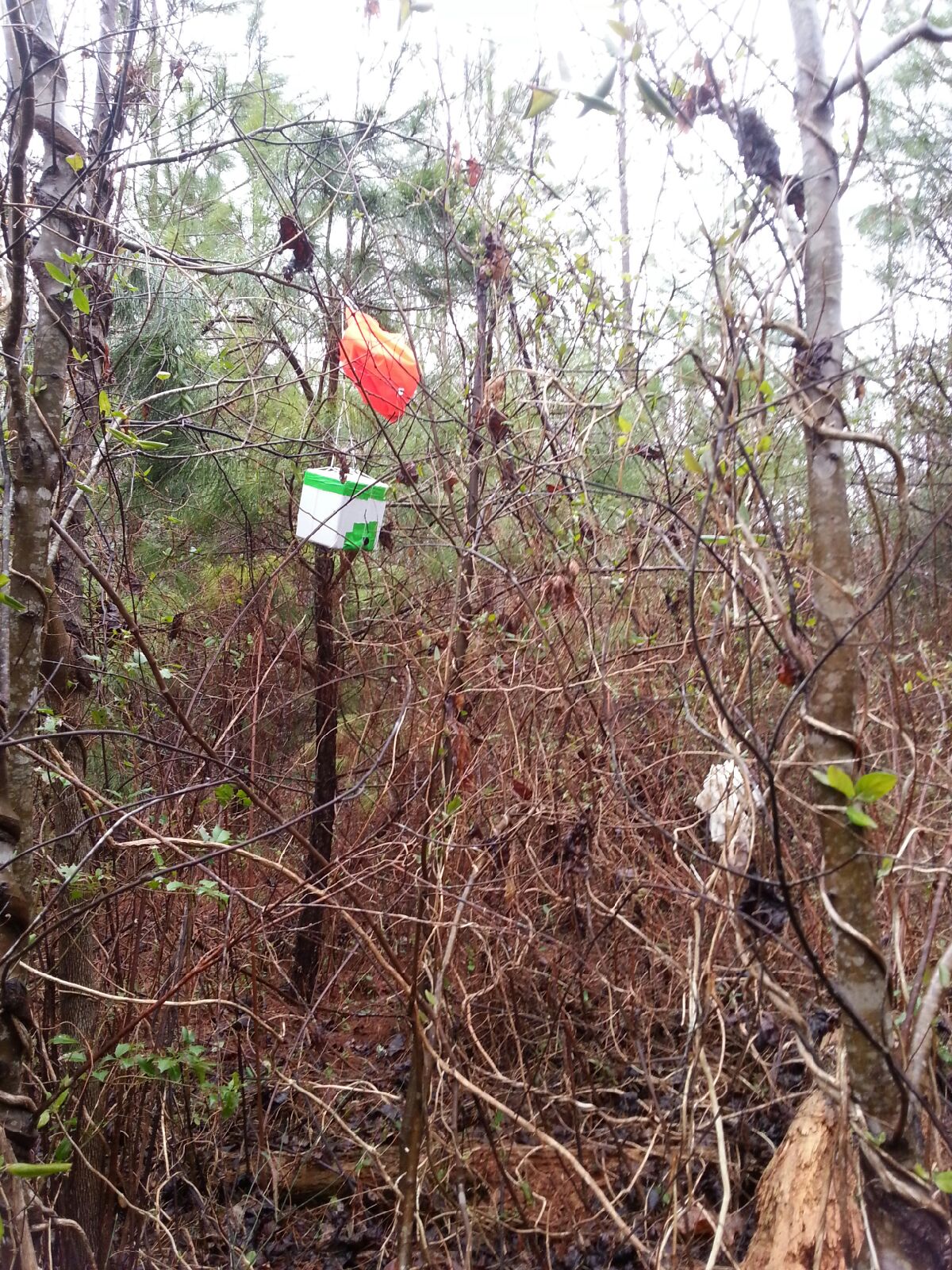
93 minutes: En route to the landing site, EFT-4 touches down. The location is in Luray, VA on a farm, smack in the middle of a field. With enough distance to the nearest tree line, we’re sure we’ll be able to pick her up, so long as someone is around that allows us on to their property.
120 minutes: After approaching the owners of the farm, we walk out to the field, and pick up Dogeship-4. The Canon camera still has the lens out but is obviously frozen in that position and no longer taking pictures, while the RioRand camera appears a bit foggy, but still in-tact. SUCCESS!
After a quick thank-you with the farm owners, we embark back to a surrounding town for some celebration BBQ.
Conclusions:
Overall, EFT-4 was a complete success. The balloon ended up landing within 2 miles of the predicted landing zone, we recovered the payload in just over 2 hours after launch, and we got some useful video on ascent. Thank you to Shaheen and Billy for their help on this successful EFT-4 launch!
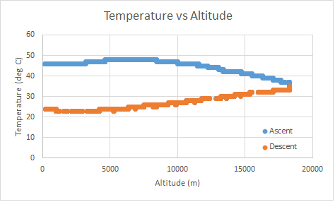
As with each of our launches thus far, we had a lot of learning and takeaways from this launch. Although we obtained video during ascent, both cameras failed roughly 20 minutes into flight (one overheated, one froze).
Flight Hardware Lessons Learned:
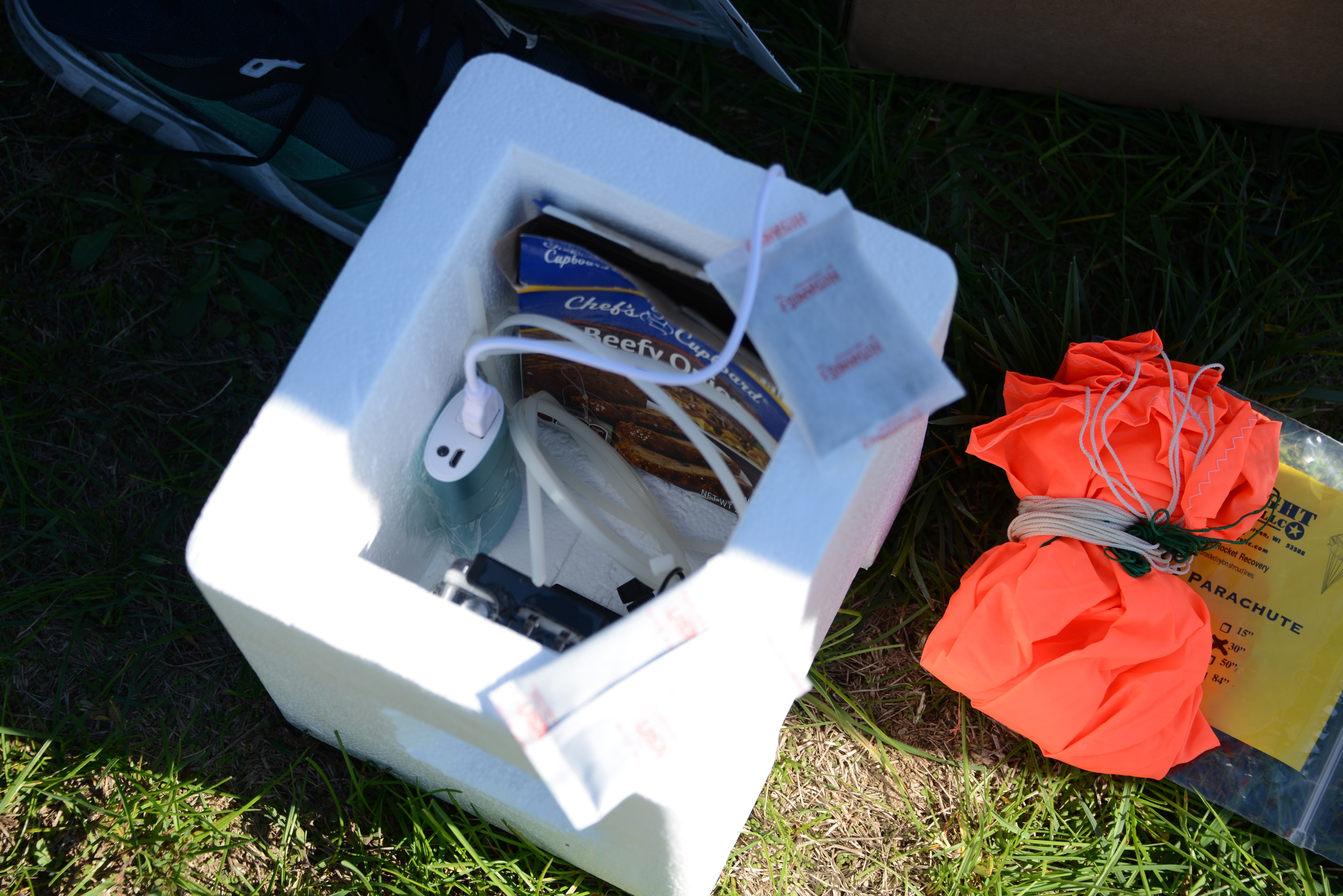
- Camera condensation started on the ground before launch and during climb on the inside of plastic camera case. We suspect that the temperature inside the case rises before launch, causing an increased dewpoint, resulting in condensation on the inside (small hole also drilled on side for charging port)
- Potential Mitigation: On future launches, using a small dessicant pack inside the camera case and better thermal control to prevent over-heating (or not using a case altogether)
- Thermal Control - 2 Hot Hands handwarmers were used. It resulted in the payload becoming very hot (likely the cause of GoPro shut-down). Sitting on the ground 30-40 minutes in the sealed Styrofoam cooler before launch contributed to the over-heating issue.
- Potential Mitigation: Active thermal system controlled by the phone; better control over the amount of time handwarmers are in the sealed payload.
- Rotation: watching the live videos for the first time (we have only received still images in the past), we notice a high frequency rotation and lower frequency but violent nutation (coning) on ascent.
- Potential Mitigation: Likely caused by a combination of factors, including fast climb velocity (over-filled balloon to burst earlier than typical), single-point string attachment to the payload. We plan to analyze these causes in more detail and can experiment with the variables on future flight to determine root cause and get a more stable platform.
Other Lessons Learned:
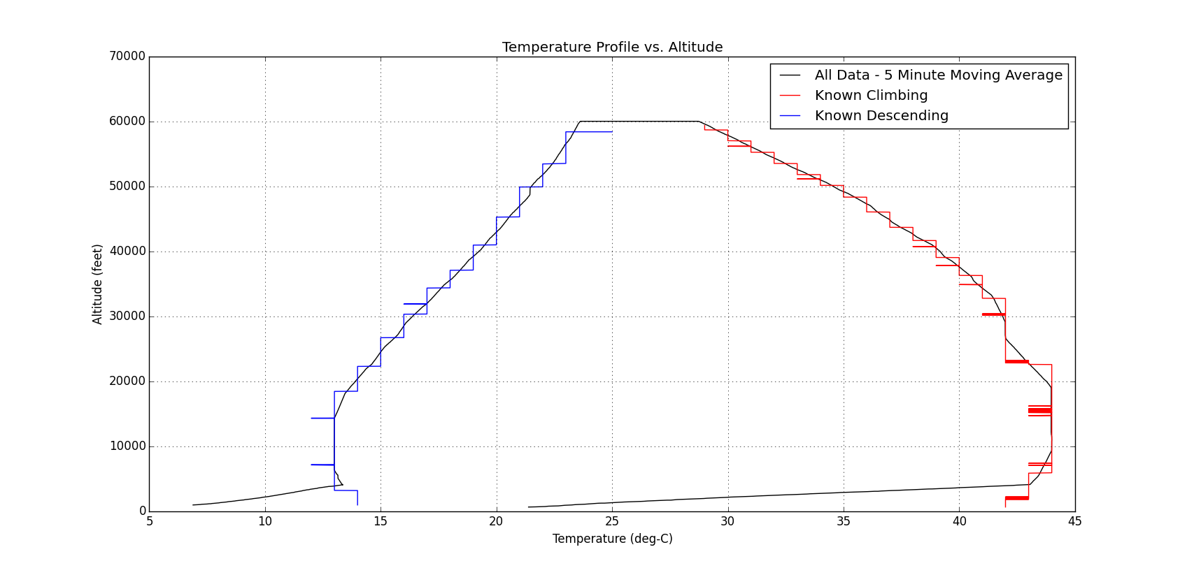
- Our previous EFT-3 launch seems an outlier for burst altitude. EFT-4 burst altitude was above 60kft and seems in line with expectations before EFT-3.
- Our devices didn’t have service/data and so we were not able to verify that SMS was enabled and working prior to launch. We plan to add audible beeping in case service goes out before launch (after payload is sealed).


 reading the posted signs that just forbid firearms and hunting on the land without a permit, we proceed to walk the mile or so towards EFT-3. SMS messages are still coming in loud and clear.
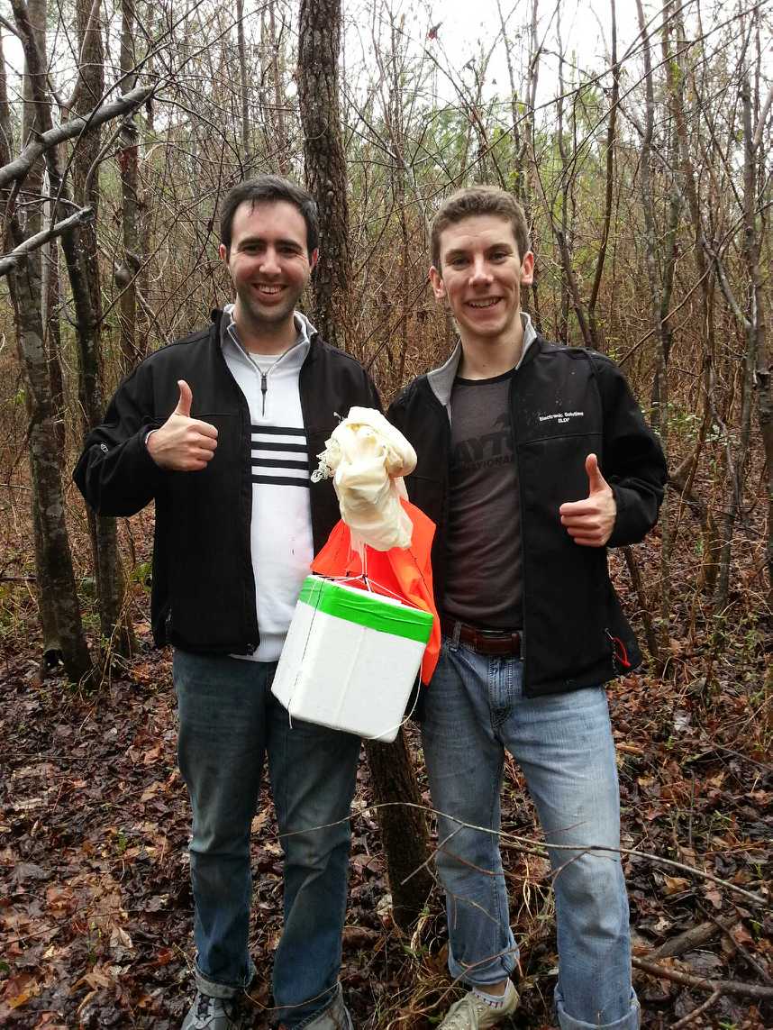

 the balloon to parachute attachment line had wound itself around the parachute
suspension lines about half way up, which
effectively reduces the line length and hence reduces the drag coefficient of the parachute. For future launches, a longer balloon to parachute attachment line should help increase stability, and hence make it more stable on ascent. Furthermore, a parachute deployment mechanism (potentially utilizing the cut-down device hardware) that waits until a prescribed altitude before deploying the parachute would decrease the changes of any lines tangling and reduces the distance and time that would be required for recovery.
the balloon to parachute attachment line had wound itself around the parachute
suspension lines about half way up, which
effectively reduces the line length and hence reduces the drag coefficient of the parachute. For future launches, a longer balloon to parachute attachment line should help increase stability, and hence make it more stable on ascent. Furthermore, a parachute deployment mechanism (potentially utilizing the cut-down device hardware) that waits until a prescribed altitude before deploying the parachute would decrease the changes of any lines tangling and reduces the distance and time that would be required for recovery.